
Northamptonshire
| |||||
| Localización | |||||
|---|---|---|---|---|---|
| |||||
| Estado | Reino Unido | ||||
| País | Inglaterra | ||||
| Rexións | Midlands do Leste | ||||
| Capital | Northampton | ||||
| Contén a división administrativa | Corby (pt) Daventry (en) East Northamptonshire (–2021) Kettering (–2021) North Northamptonshire (2021–) Northampton (–2021) Oeste de Northamptonshire (pt) South Northamptonshire (–2021) Wellingborough (–2021) | ||||
| Poboación | |||||
| Poboación | 757.181 (2020) | ||||
| Xeografía | |||||
| Superficie | 2.364,0051 km² | ||||
| Comparte fronteira con | |||||
| Organización política | |||||
| Órgano lexislativo | council of Northamptonshire County Council (en) | ||||
| ISO 3166-2 | GB-NTH | ||||
| Outro | |||||
| Irmandado con | Indianapolis (2009–) | ||||
| Páxina web | northamptonshire.gov.uk | ||||


Northamptonshire é un condado do Reino Unido, situado no centro de Inglaterra. Ocupa unha área de 2.364 km², cunha poboación estimada en 2010 de 687.300 habitantes. A sede do goberno está no distrito de Northampton, a vila máis poboada do condado.
Northamptonshire limita con Warwickshire, Leicestershire, Rutland, Cambridgeshire, Bedfordshire, Buckinghamshire, Oxfordshire e Lincolnshire.
Distritos[editar | editar a fonte]

| Distritos de Northamptonshire | |||||||
|---|---|---|---|---|---|---|---|
| Nº | Distrito | Poboación | |||||
| 1 | South Northamptonshire | 88.800 | |||||
| 2 | Northampton | 212.100 | |||||
| 3 | Daventry | 79.000 | |||||
| 4 | Wellingborough | 75.700 | |||||
| 5 | Kettering | 90.600 | |||||
| 6 | Corby | 55.800 | |||||
| 7 | East Northamptonshire | 85.300 | |||||
Galería[editar | editar a fonte]
-
-
 Northampton Guildhall.
 -
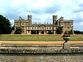 Castelo de Ashby.
 -
 Canle Grand Union.


Véxase tamén[editar | editar a fonte]
Outros artigos[editar | editar a fonte]
| Commons ten máis contidos multimedia sobre: Northamptonshire |