
Ficheiro:Dalby City of Troy turf maze.jpg
Tamaño desta vista previa: 800 × 511 píxeles. Outras resolucións: 320 × 205 píxeles | 640 × 409 píxeles | 1.134 × 725 píxeles.
Ficheiro orixinal (1.134 × 725 píxeles; tamaño do ficheiro: 1,05 MB; tipo MIME: image/jpeg)
| Este ficheiro procede de Wikimedia Commons. A continuación móstrase a información da súa páxina de descrición. Commons é un repositorio libre de ficheiros multimedia. Pode contribuír alí cargando as súas imaxes. |
Resumo
| Descrición |
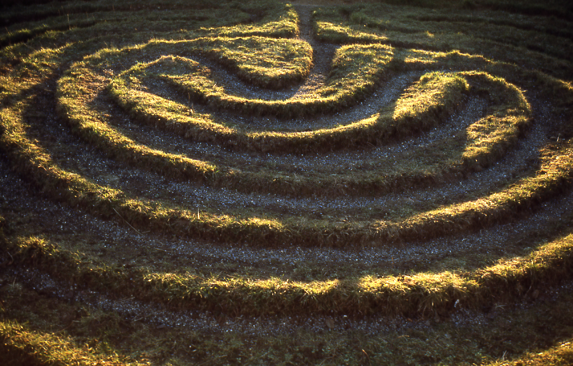
English: City of Troy. The only surviving example in the North Riding of this type of grass maze. It is located by a roadside in the Howardian Hills of Yorkshire, England, near the villages of Dalby, and Skewsby, close to Sheriff Hutton, a few miles north of York.
It is at grid reference SE6252871886 in Bonnygate Lane / High Lane. For some reason neither the Landranger map nor the Victorian Ordnance Survey map mark it. See the Megalithic Portal. Another image from Geograph. |
| Data | |
| Orixe | This is a scan of a transparency which I took in the 1970s, scanned and uploaded 8 May 2005. It has been slightly cleaned-up in Photoshop. |
| Autoría | User:SiGarb |
| Licenza (Reuso deste ficheiro) |
Own work, all rights released. This version of the image is in the Public Domain. If it is used outside Wikipedia, a photographer's credit (Simon Garbutt) would be appreciated! |
| Outras versións | (I retain the ownership and copyright of the original transparency and any higher-resolution scans derived from it.) SiGarb 18:46, 8 November 2005 (UTC) |
| Localización da cámara | | Esta e outras imaxes na súa localización en: OpenStreetMap |
|---|
Licenza
| Eu, como posuidor dos dereitos de autor desta obra, libéroa para que pertenza ao dominio público. Isto é válido en todo o mundo. Nalgúns países, isto pode non ser legalmente posible; entón: Concedo a calquera o dereito de empregar esta obra para o propósito que considere oportuno, sen condicións, agás aquelas que sexan requiridas pola lei. |
Historial do ficheiro
Prema nunha data/hora para ver o ficheiro tal e como estaba nese momento.
| Data/Hora | Miniatura | Dimensións | Usuario | Comentario | |
|---|---|---|---|---|---|
| actual | 8 de novembro de 2005 ás 18:46 | | 1.134 × 725 (1,05 MB) | SiGarb | This is a scan of a transparency which I took in the 1970s. It has been slightly cleaned-up in Photoshop. It shows "The City of Troy", a roadside turf maze in the Howardian Hills of Yorkshire, England, near the villages of Dalby, and Skewsby, close to S |
Uso do ficheiro
A seguinte páxina usa este ficheiro:
Uso global do ficheiro
Os seguintes wikis empregan esta imaxe:
- Uso en cs.wikipedia.org
- Uso en de.wikipedia.org
- Uso en en.wikipedia.org
- Uso en es.wikipedia.org
- Uso en et.wikipedia.org
- Uso en fi.wikipedia.org
- Uso en ja.wikipedia.org
- Uso en nl.wikipedia.org
- Uso en ru.wikipedia.org
- Uso en th.wikipedia.org