
Ficheiro:Kleinasien II.jpg
Ficheiro orixinal (3.046 × 1.690 píxeles; tamaño do ficheiro: 933 kB; tipo MIME: image/jpeg)
| Este ficheiro procede de Wikimedia Commons. A continuación móstrase a información da súa páxina de descrición. Commons é un repositorio libre de ficheiros multimedia. Pode contribuír alí cargando as súas imaxes. |
| Descrición |
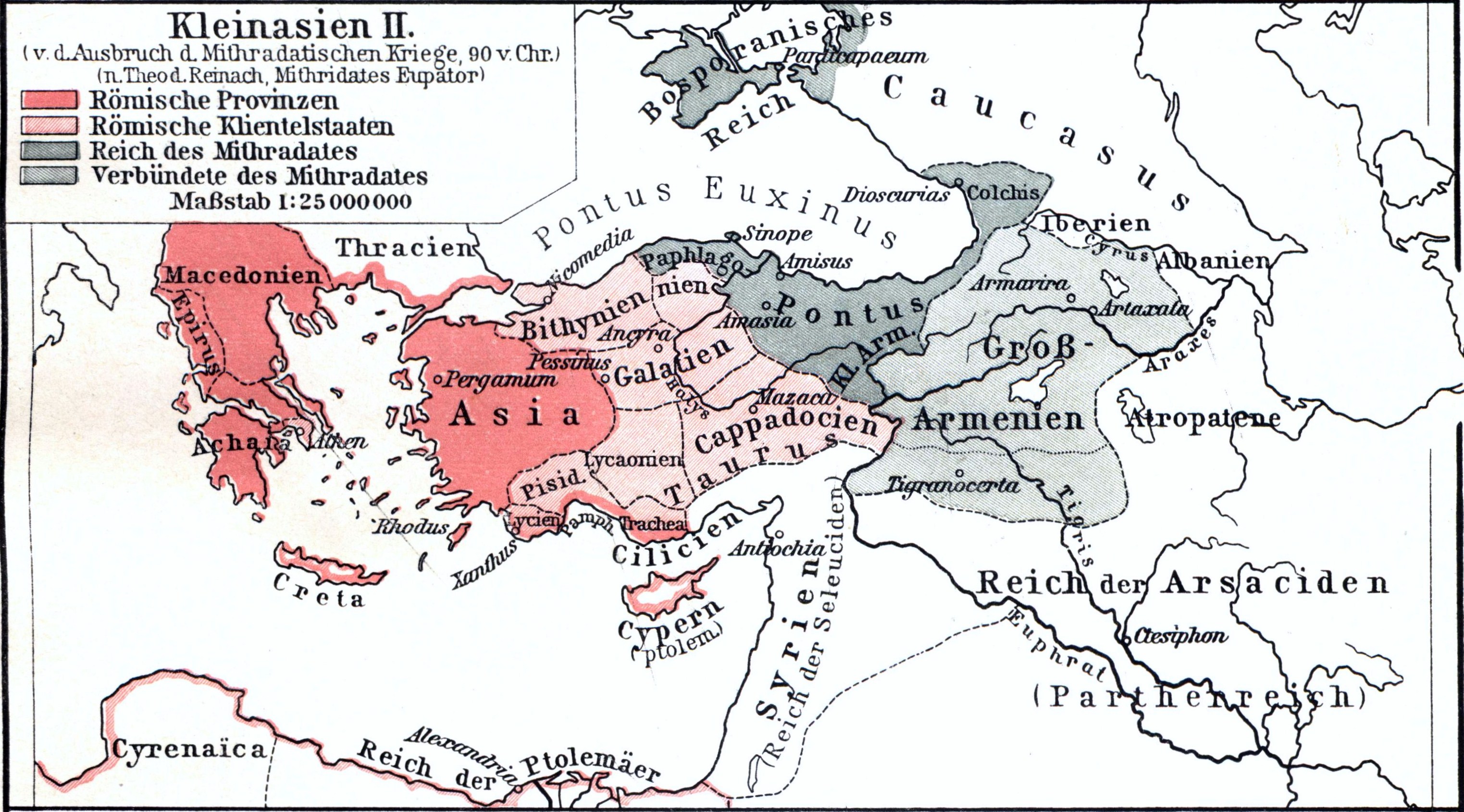
Deutsch: Karte von Kleinasien vor dem Ausbruch der Mithridatischen Kriege 90 v. Chr.
English: Map of Asia Minor before the outbreak of the Mithridatic Wars 90 BC. Chr. |
||||
| Data | antes do 1901 | ||||
| Orixe | F. W. Putzgers Historischer Schul-Atlas, 25. Auflage, 1901 | ||||
| Autoría | Herausgeber (Editors): Alfred Baldamus, Ernst Schwabe | ||||
| Licenza (Reuso deste ficheiro) |
|
||||
Historial do ficheiro
Prema nunha data/hora para ver o ficheiro tal e como estaba nese momento.
| Data/Hora | Miniatura | Dimensións | Usuario | Comentario | |
|---|---|---|---|---|---|
| actual | 20 de marzo de 2012 ás 21:45 | | 3.046 × 1.690 (933 kB) | Oltau | {{Information |Description={{de|1=Karte von Kleinasien vor dem Ausbruch der Mithradatischen Kriege 90 v. Chr.}} |Source=F. W. Putzgers Historischer Schul-Atlas, 25. Auflage, 1901 |Author=Herausgeber (Editors): Alfred Baldamus, Ernst Schwabe |... |
Uso do ficheiro
A seguinte páxina usa este ficheiro:
Uso global do ficheiro
Os seguintes wikis empregan esta imaxe:
- Uso en de.wikipedia.org
- Uso en en.wikipedia.org
- Uso en mk.wikipedia.org
- Uso en mt.wikipedia.org
- Uso en pt.wikipedia.org