
Ficheiro:Amchitka Island Map.jpg
Non se pode ver nunha resolución meirande.
Amchitka_Island_Map.jpg (794 × 564 píxeles; tamaño do ficheiro: 113 kB; tipo MIME: image/jpeg)
| Este ficheiro procede de Wikimedia Commons. A continuación móstrase a información da súa páxina de descrición. Commons é un repositorio libre de ficheiros multimedia. Pode contribuír alí cargando as súas imaxes. |
| Descrición |
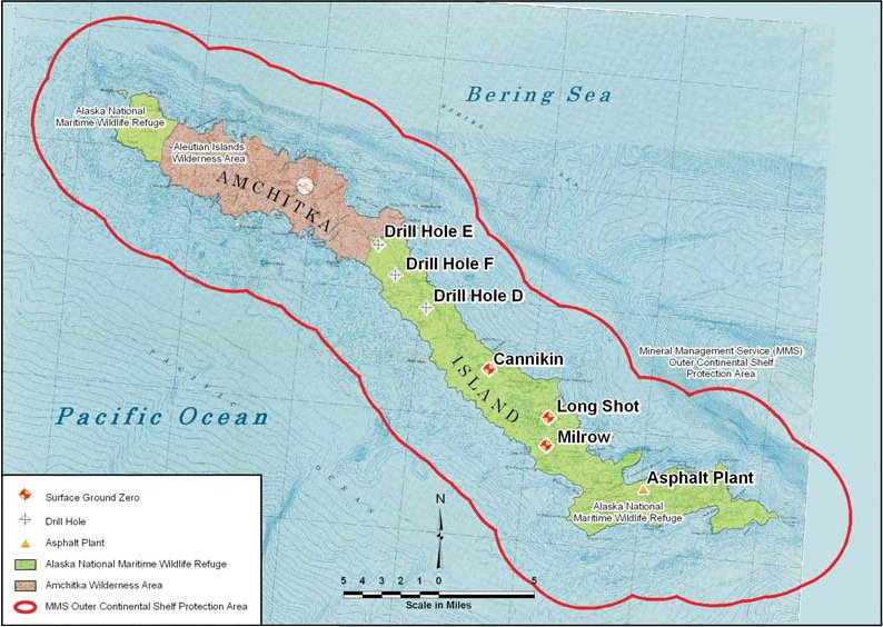
English: Map of Amchitka Island. |
|||
| Data | Data descoñecida | |||
| Orixe | Amchitka Site Fact Sheet | |||
| Autoría | Federal Government of the United States | |||
| Licenza (Reuso deste ficheiro) |
|

Historial do ficheiro
Prema nunha data/hora para ver o ficheiro tal e como estaba nese momento.
| Data/Hora | Miniatura | Dimensións | Usuario | Comentario | |
|---|---|---|---|---|---|
| actual | 19 de setembro de 2011 ás 15:23 | | 794 × 564 (113 kB) | Bomazi | {{Information |Description ={{en|1=Map of Amchitka Island.}} |Source =http://www.lm.doe.gov/Amchitka/Sites.aspx |Author =Federal Government of the United States |Date = |Permission ={{PD-USGov-DOE}} |other_versions = }} [ |
Uso do ficheiro
A seguinte páxina usa este ficheiro:
Uso global do ficheiro
Os seguintes wikis empregan esta imaxe: