
Ficheiro:ReliefUSA map.gif
Non se pode ver nunha resolución meirande.
ReliefUSA_map.gif (714 × 496 píxeles; tamaño do ficheiro: 228 kB; tipo MIME: image/gif)
| Este ficheiro procede de Wikimedia Commons. A continuación móstrase a información da súa páxina de descrición. Commons é un repositorio libre de ficheiros multimedia. Pode contribuír alí cargando as súas imaxes. |
Resumo
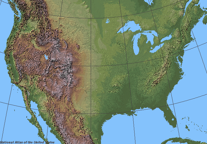
Shaded relief in the lower 48 states of the United States of America.
Licenza
This map was obtained from an edition of the National Atlas of the United States. Like almost all works of the U.S. federal government, works from the National Atlas are in the public domain in the United States.
Online access: NationalAtlas.gov | 1970 print edition: Library of Congress, Perry-Castañeda Library
|
derivative works
Obras derivadas deste ficheiro:
Historial do ficheiro
Prema nunha data/hora para ver o ficheiro tal e como estaba nese momento.
| Data/Hora | Miniatura | Dimensións | Usuario | Comentario | |
|---|---|---|---|---|---|
| actual | 5 de xuño de 2006 ás 06:07 | | 714 × 496 (228 kB) | Urban~commonswiki | ==Description== Shaded relief in the lower 48 states of the United States of America. ==License== {{PD-USGov-Atlas}} |
Uso do ficheiro
Non hai páxinas que usen este ficheiro.
Uso global do ficheiro
Os seguintes wikis empregan esta imaxe:
- Uso en fr.wikipedia.org
- Wikipédia:Wikiconcours/mars 2008/Équipes
- Discussion Wikipédia:Wikiconcours/mars 2008/Équipes/Équipe 10
- Discussion Wikipédia:Wikiconcours/mars 2008/Équipes/Équipe 10/Mammoth
- Discussion Wikipédia:Wikiconcours/mars 2008/Équipes/Équipe 10/Denver
- Discussion Wikipédia:Wikiconcours/mars 2008/Équipes/Équipe 10/Baltimore
- Discussion Wikipédia:Wikiconcours/mars 2008/Équipes/Équipe 10/Glacier
- Discussion Wikipédia:Wikiconcours/mars 2008/Équipes/Équipe 10/Modèle
- Discussion Wikipédia:Wikiconcours/mars 2008/Équipes/Équipe 10/Louisville
- Uso en sco.wikipedia.org
- Uso en sl.wikipedia.org