
Ficheiro:Europe mediterranean 1097.jpg

Ficheiro orixinal (2.270 × 1.789 píxeles; tamaño do ficheiro: 4,85 MB; tipo MIME: image/jpeg)
| Este ficheiro procede de Wikimedia Commons. A continuación móstrase a información da súa páxina de descrición. Commons é un repositorio libre de ficheiros multimedia. Pode contribuír alí cargando as súas imaxes. |


|
This map has been uploaded by Electionworld from en.wikipedia.org to enable the |
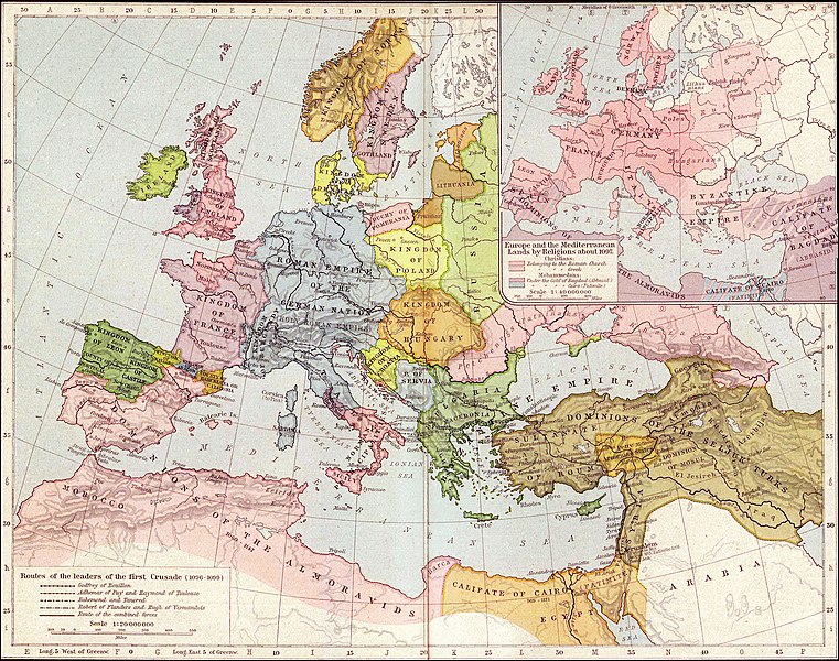
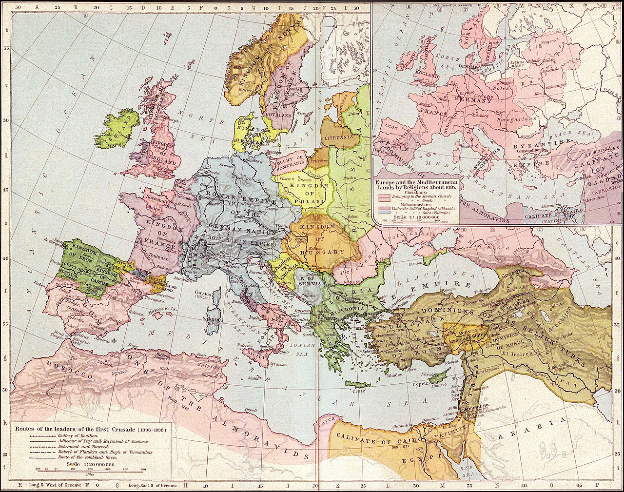
Map of Mediterranean and European lands anout 1097. Map from: Historical Atlas by William Shepherd (1923-26), in Public Domain
|
Este material está no dominio público nos demais países onde os dereitos de autor se estenden por 70 anos (ou menos) trala morte do autor.
| |
| Este ficheiro foi identificado como libre de restricións baixo as leis de dereitos de autor, incluídos todos os dereitos relacionados. | |
.jpg)
Historial do ficheiro
Prema nunha data/hora para ver o ficheiro tal e como estaba nese momento.
| Data/Hora | Miniatura | Dimensións | Usuario | Comentario | |
|---|---|---|---|---|---|
| actual | 27 de setembro de 2021 ás 03:36 | | 2.270 × 1.789 (4,85 MB) | GPinkerton | Reverted to version as of 01:31, 30 January 2007 (UTC) do not alter historical maps! |
| 26 de xuño de 2020 ás 18:03 |  | 2.270 × 1.789 (4,84 MB) | Claude Zygiel | Map of Europe and Mediterranean lands about 1097: Byzantine Empire had not been completely excluded from Anatolia (Mantzikert, 1071) and the lower Danube was not pagan even if Pechenegs were Tengrists. | |
| 30 de xaneiro de 2007 ás 01:31 |  | 2.270 × 1.789 (4,85 MB) | Patrickneil | {{ew|en|Wirya}} Map of Kurdistan and Mediterranean and European lands anout 1097. Map from: [http://www.lib.utexas.edu/maps/historical/shepherd/europe_mediterranean_1097.jpg], in Public Domain {{PD-old}} | |
| 3 de decembro de 2006 ás 14:59 |  | 2.314 × 1.805 (725 kB) | Electionworld | {{ew|en|Wirya}} Map of Kurdistan and Mediterranean and European lands anout 1097. Map from: [http://www.lib.utexas.edu/maps/historical/shepherd/europe_mediterranean_1097.jpg], in Public Domain {{PD}} |
Uso do ficheiro
As seguintes 2 páxinas usan este ficheiro:
Uso global do ficheiro
Os seguintes wikis empregan esta imaxe:
- Uso en ast.wikipedia.org
- Uso en ba.wikipedia.org
- Uso en bg.wikipedia.org
- Uso en ce.wikipedia.org
- Uso en ckb.wikipedia.org
- Uso en de.wikipedia.org
- Uso en el.wikipedia.org
- Uso en en.wikipedia.org
- Uso en es.wikipedia.org
- Uso en et.wikipedia.org
- Uso en fa.wikipedia.org
- Uso en fr.wikipedia.org
- Uso en hu.wikipedia.org
- Uso en id.wikipedia.org
- Uso en it.wikipedia.org
- Uso en ms.wikipedia.org
- Uso en nn.wikipedia.org
- Uso en pnb.wikipedia.org
- Uso en pt.wikipedia.org
- Uso en ro.wikipedia.org
- Uso en ru.wikipedia.org
- Uso en ta.wikipedia.org
Ollar o uso global deste ficheiro.