
Ficheiro:2d Map of Ireland- first Irish postage stamp.jpg
Non se pode ver nunha resolución meirande.
2d_Map_of_Ireland-_first_Irish_postage_stamp.jpg (331 × 391 píxeles; tamaño do ficheiro: 31 kB; tipo MIME: image/jpeg)
| Este ficheiro procede de Wikimedia Commons. A continuación móstrase a información da súa páxina de descrición. Commons é un repositorio libre de ficheiros multimedia. Pode contribuír alí cargando as súas imaxes. |
Resumo
| Descrición |
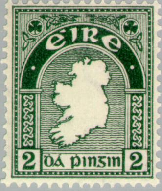
Français : Timbre postal 'Carte d'Irlande' publié pour la première fois le 6 décembre 1922
English: 2d 'Map of Ireland' postage stamp first issued 6 December 1922 |
| Data | |
| Orixe | Europeanstamps.net |
| Autoría | Department of Posts and Telegraphs |
| Licenza (Reuso deste ficheiro) |
Français : Domaine public (tous les copyright du gouvernement irlandais expirent 50 ans après la création de l'objet d'après la loi irlandaise) English: Public domain (all Irish Government copyright terminates 50 years after the work was made according to the appropriate Irish law) |
Licenza
This Irish Government or Oireachtas work is in the public domain. According to Chapter 19, §191-193 of the Copyright and Related Rights Act, 2000, copyright has expired in Ireland because it is either:
|
 |
Historial do ficheiro
Prema nunha data/hora para ver o ficheiro tal e como estaba nese momento.
| Data/Hora | Miniatura | Dimensións | Usuario | Comentario | |
|---|---|---|---|---|---|
| actual | 16 de agosto de 2007 ás 09:04 | | 331 × 391 (31 kB) | Kokin | {{Information |Description={{fr}}Timbre postal 'Carte d'Irlande' publié pour la première fois le 6 décembre 1922{{en}}2d 'Map of Ireland' postage stamp first issued 6 December 1922 |Source=[[http://www.europeanstamps.net/imagedb2/details.asp?id=8694 Eu |
Uso do ficheiro
A seguinte páxina usa este ficheiro:
Uso global do ficheiro
Os seguintes wikis empregan esta imaxe:
- Uso en ar.wikipedia.org
- Uso en en.wikipedia.org
- Shamrock
- Postage stamps of Ireland
- Portal:Philately/Selected article archive
- Wikipedia:Today's featured article/August 2007
- Wikipedia:Today's featured article/August 14, 2007
- 1935 Irish 2d coil stamp
- Definitive postage stamps of Ireland
- Portal:Philately/Selected article archive/2
- Portal:Ireland/Selected article archive
- Portal:Ireland/Selected article archive/28
- Portal:Europe/Selected article
- Portal:Europe/Selected article/8
- Uso en es.wikipedia.org
- Uso en fa.wikipedia.org
- Uso en fr.wikipedia.org
- Uso en ga.wikipedia.org
- Uso en he.wikipedia.org
- Uso en no.wikipedia.org
- Uso en pl.wikipedia.org
- Znaczki pocztowe w Irlandii
- Wikipedia:Artykuły na medal/Lipiec i sierpień 2012
- Szablon:Dobry artykuł/archiwum/2012/06
- Portal:Filatelistyka/Artykuł miesiąca/archiwum
- Wikipedia:Zajawka wyróżnionego artykułu/Znaczki pocztowe w Irlandii
- Wikipedia:Artykuły na Medal/archiwum/2012-07
- Wikipedia:Artykuły na Medal/archiwum/2012-08
- Wikipedia:Artykuły na Medal/zajawki/Znaczki pocztowe w Irlandii
- Uso en pt.wikipedia.org
- Uso en ru.wikipedia.org
- Uso en scn.wikipedia.org
- Uso en simple.wikipedia.org
- Uso en sr.wikipedia.org
- Uso en vi.wikipedia.org