
Ficheiro:NASA Radar 3-D View of San Andreas Fault.jpg
Tamaño desta vista previa: 654 × 600 píxeles. Outras resolucións: 262 × 240 píxeles | 523 × 480 píxeles | 837 × 768 píxeles | 1.116 × 1.024 píxeles | 2.233 × 2.048 píxeles | 2.984 × 2.737 píxeles.
Ficheiro orixinal (2.984 × 2.737 píxeles; tamaño do ficheiro: 7,6 MB; tipo MIME: image/jpeg)
| Este ficheiro procede de Wikimedia Commons. A continuación móstrase a información da súa páxina de descrición. Commons é un repositorio libre de ficheiros multimedia. Pode contribuír alí cargando as súas imaxes. |
Resumo
| Descrición |
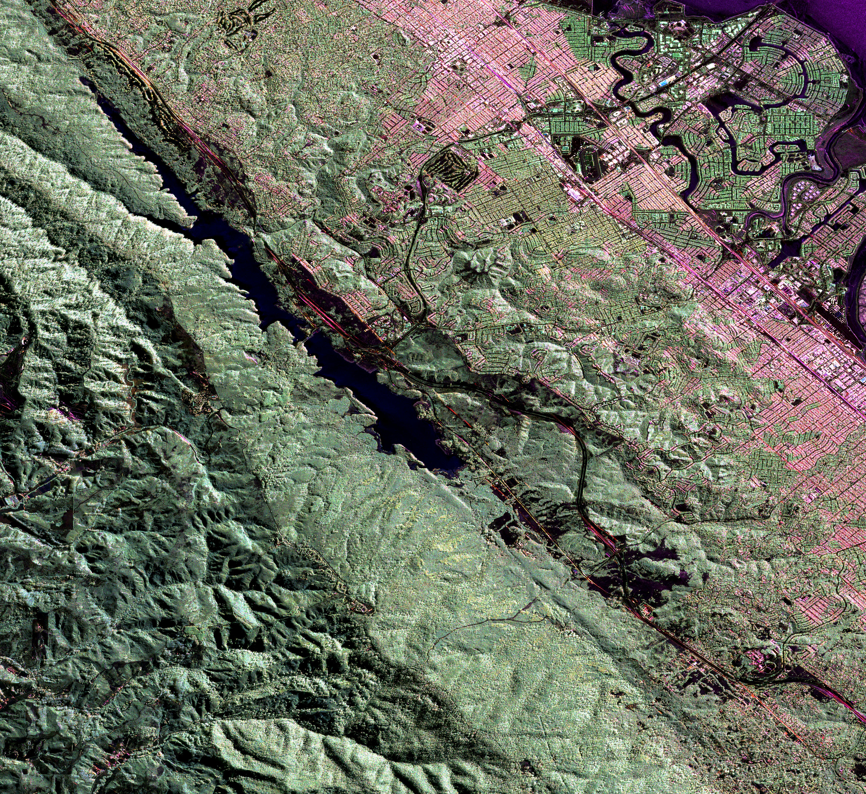
English: Much of the length of the San Andreas Fault is lined by a distinct trough. This false-colour radar image shows a section of the fault west of San Francisco Bay; the Crystal Springs Reservoir fills the trough that marks the underlying fault. The black line curving along the east side of the fault is I-280, and California highway 92 runs from the top right across to the centre left of the image, heading towards Half Moon Bay to the west. San Mateo and Burlingame are parts of the large urbanized area in various tones of pink and green, and Foster City is the area of curved streets extending out into the San Francisco Bay at the top right. |
| Data | |
| Orixe | NASA Earth Observatory |
| Autoría | Image courtesy of the NASA Jet Propulsion Laboratory. |
Instrument: Aircraft Sensors - UAVSARS
Licenza
| Este ficheiro está no dominio público porque foi creado pola NASA. A política do copyright da NASA declara que "o material da NASA non está protexido polos dereitos de autor a non ser que se indique o contrario". (Páxina de políticas do copyright da NASA ou política de uso de imaxes JPL). | ||
 |
Avisos:
|
Historial do ficheiro
Prema nunha data/hora para ver o ficheiro tal e como estaba nese momento.
| Data/Hora | Miniatura | Dimensións | Usuario | Comentario | |
|---|---|---|---|---|---|
| actual | 23 de xuño de 2009 ás 09:27 | | 2.984 × 2.737 (7,6 MB) | Originalwana | {{Information |Description={{en|1=Much of the length of the San Andreas Fault is lined by a distinct trough. This false-colour radar image shows a section of the fault west of San Francisco Bay; the Crystal Springs Reservoir fills the trough that marks th |
Uso do ficheiro
A seguinte páxina usa este ficheiro:
Uso global do ficheiro
Os seguintes wikis empregan esta imaxe:
- Uso en en.wikipedia.org
- Uso en id.wikipedia.org
- Uso en simple.wikipedia.org