
Ficheiro:Germany adm location map.svg

Ficheiro orixinal (ficheiro SVG; resolución de 1.073 × 1.272 píxeles; tamaño do ficheiro: 643 kB)
| Este ficheiro procede de Wikimedia Commons. A continuación móstrase a información da súa páxina de descrición. Commons é un repositorio libre de ficheiros multimedia. Pode contribuír alí cargando as súas imaxes. |
Resumo
| Descrición |
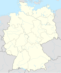
Deutsch: Positionskarte von Deutschland
English: Location map of Germany
|
||||||||||||
| Data | |||||||||||||
| Orixe |
Obra própria, usando:
|
||||||||||||
| Autoría | NordNordWest | ||||||||||||
| SVG desenvolvimento | Esta imaxe vectorial foi creada co Adobe Illustrator por NordNordWest Esta carta geográfica SVG emprega texto encapsulado que pode ser traducido de xeito doado cun editor de texto.
|
||||||||||||

Licenza
Usage of this file with:

explanatory notes: Legally binding is only the full legalcode. For a free usage I recommend to respect the following licence conditions:
1. Provide my name as given above: NordNordWest,
2. a copy of, or the URI for, the applicable license: https://creativecommons.org/licenses/by-sa/3.0/de/legalcode,
3. the title of the work,
4. in the case of an adaptation, a credit identifying the use of the work in the adaptation.
This license and the rights granted hereunder will terminate automatically upon any breach by you of the terms of this license. Any of the above conditions can be waived if you get permission from the copyright holder. If you have questions or wish differing conditions, please contact me through nnwest or my discussion page ![]() t-online.de
t-online.de
- Vostede é libre de:
- compartir – copiar, distribuír e difundir a obra
- facer obras derivadas – adaptar a obra
- Baixo as seguintes condicións:
- recoñecemento – Debe indicar a debida atribución de autoría, fornecer unha ligazón á licenza e indicar se se realizaron cambios. Pode facer isto de calquera forma razoable, mais non nunha forma que indique que quen posúe a licenza apoia ou subscribe o seu uso da obra.
- compartir igual – Se altera, transforma ou amplía este contido, debe publicar as súas contribucións baixo a mesma licenza ou outra compatible á orixinal.

Historial do ficheiro
Prema nunha data/hora para ver o ficheiro tal e como estaba nese momento.
| Data/Hora | Miniatura | Dimensións | Usuario | Comentario | |
|---|---|---|---|---|---|
| actual | 15 de setembro de 2014 ás 17:46 | | 1.073 × 1.272 (643 kB) | NordNordWest | == {{int:filedesc}} == {{Information |Description= {{de|1=Positionskarte von Deutschland}} {{en|1=Location map of Germany}} {{Location map series N |top=55.1 |bottom=47.2 |left=5.5 |right=15.5 }} |Source={{Own using}} * United States National Imagery a... |
Uso do ficheiro
A seguinte páxina usa este ficheiro:
Uso global do ficheiro
Os seguintes wikis empregan esta imaxe:
- Uso en af.wikipedia.org
- Heiligendamm
- Lughawe Frankfurt
- Züsedom
- Breinigerberg
- Passau
- Berlyn-Brandenburg Internasionale Lughawe
- Caputh
- Tempelhof-lughawe
- Brobergen
- Bayreuth
- Bimmen
- FIFA Sokker-Wêreldbekertoernooi in 2006
- FIFA Sokker-Konfederasiebeker in 2005
- Kronberg im Taunus
- Eschborn
- Schwalbach am Taunus
- Steinstücken
- Eltville am Rhein
- Bad Homburg vor der Höhe
- Friedrichsdorf
- Hanau
- Limburg an der Lahn
- Lorsch
- Gelnhausen
- Gießen
- Königstein im Taunus
- Freudenstadt
- Sylt (munisipaliteit)
- Kiedrich
- Selters (Taunus)
- Hochheim am Main
- Sellin
- Friedersdorf (Heidesee)
- Oberbillig
- Neuendettelsau
- Geesterivier
- Hamburg Lughawe
- Düsseldorf Lughawe
- Duitse nasionale krieketspan
- Uso en ar.wikipedia.org
Ollar o uso global deste ficheiro.