
Ficheiro:Riparian strip.jpg
Non se pode ver nunha resolución meirande.
Riparian_strip.jpg (655 × 441 píxeles; tamaño do ficheiro: 59 kB; tipo MIME: image/jpeg)
| Este ficheiro procede de Wikimedia Commons. A continuación móstrase a información da súa páxina de descrición. Commons é un repositorio libre de ficheiros multimedia. Pode contribuír alí cargando as súas imaxes. |
| Localización do obxectivo | | Esta e outras imaxes na súa localización en: OpenStreetMap |
|---|
| Descrición |
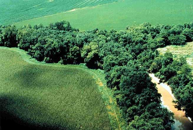
English: Riparian strip on a Lake Erie tributary. Location is the northeastern corner of Van Buren Township, Putnam County, Ohio, United States, east of the village of Belmore; this is the confluence of Yellow Creek and a tiny unnamed run. |
|||
| Data | Data descoñecida | |||
| Orixe | [1] (context) | |||
| Autoría | U.S. Department of Agriculture | |||
| Licenza (Reuso deste ficheiro) |
|

![[1]](https://web.archive.org/web/20051220220554/http://www.oh.nrcs.usda.gov/programs/Lake_Erie_Buffer/images/riparian_putnam_co.jpg)
Historial do ficheiro
Prema nunha data/hora para ver o ficheiro tal e como estaba nese momento.
| Data/Hora | Miniatura | Dimensións | Usuario | Comentario | |
|---|---|---|---|---|---|
| actual | 28 de xullo de 2005 ás 22:29 | | 655 × 441 (59 kB) | Duk | Riparian strip, Putnam County, Ohio, Lake Erie tributary. {{PD-USGov-USDA}} source: http://www.oh.nrcs.usda.gov/programs/Lake_Erie_Buffer/images/riparian_putnam_co.jpg en:Riparian strips |
Uso do ficheiro
A seguinte páxina usa este ficheiro:
Uso global do ficheiro
Os seguintes wikis empregan esta imaxe:
- Uso en an.wikipedia.org
- Uso en ar.wikipedia.org
- Uso en be.wikipedia.org
- Uso en bn.wikipedia.org
- Uso en bs.wikipedia.org
- Uso en ca.wikipedia.org
- Uso en cs.wikipedia.org
- Uso en cy.wikipedia.org
- Uso en en.wikipedia.org
- Uso en en.wiktionary.org
- Uso en eo.wikipedia.org
- Uso en es.wikipedia.org
- Uso en eu.wikipedia.org
- Uso en fa.wikipedia.org
- Uso en fi.wikipedia.org
- Uso en fr.wikipedia.org
- Uso en id.wikipedia.org
- Uso en it.wikipedia.org
- Uso en ja.wikipedia.org
- Uso en ka.wikipedia.org
- Uso en ko.wikipedia.org
- Uso en nl.wikipedia.org
- Uso en oc.wikipedia.org
- Uso en pt.wikipedia.org
- Uso en ru.wikipedia.org
- Uso en sh.wikipedia.org
- Uso en sv.wikipedia.org
- Uso en tt.wikipedia.org
- Uso en uk.wikipedia.org
- Uso en www.wikidata.org
Ollar o uso global deste ficheiro.