
Ficheiro:Carolingian empire 814.svg

Tamaño desta vista previa en PNG do ficheiro en formato SVG: 619 × 599 píxeles. Outras resolucións: 248 × 240 píxeles | 496 × 480 píxeles | 793 × 768 píxeles | 1.058 × 1.024 píxeles | 2.116 × 2.048 píxeles | 1.092 × 1.057 píxeles.
Ficheiro orixinal (ficheiro SVG; resolución de 1.092 × 1.057 píxeles; tamaño do ficheiro: 237 kB)
| Este ficheiro procede de Wikimedia Commons. A continuación móstrase a información da súa páxina de descrición. Commons é un repositorio libre de ficheiros multimedia. Pode contribuír alí cargando as súas imaxes. |
Resumo
| Descrición |
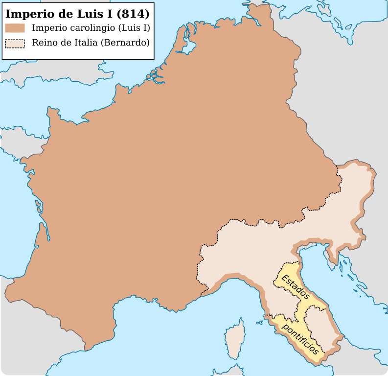
Español: Imperio carolingio al ascenso del emperador Luis I (814) |
| Data | |
| Orixe |
Obra propia
|
| Autoría | Trasamundo |
| Outras versións |
|


Licenza
Eu, como posuidor dos dereitos de autor desta obra, pola presente publícoa baixo as seguintes licenzas:

|
Autorízase a copia, distribución e/ou modificación deste documento baixo os termos da licenza de documentación libre GNU, versión 1.2 ou calquera outra que posteriormente publique a Free Software Foundation; sen seccións invariables, textos de portada, nin textos de contraportada. Inclúese unha copia da devandita licenza na sección titulada GNU Free Documentation License. |
Este ficheiro está licenciado baixo as licenzas Creative Commons recoñecemento compartir igual 3.0 Unported, recoñecemento compartir igual xenérico 2.5, recoñecemento compartir igual xenérico 2.0 e recoñecemento compartir igual xenérico 1.0.
- Vostede é libre de:
- compartir – copiar, distribuír e difundir a obra
- facer obras derivadas – adaptar a obra
- Baixo as seguintes condicións:
- recoñecemento – Debe indicar a debida atribución de autoría, fornecer unha ligazón á licenza e indicar se se realizaron cambios. Pode facer isto de calquera forma razoable, mais non nunha forma que indique que quen posúe a licenza apoia ou subscribe o seu uso da obra.
- compartir igual – Se altera, transforma ou amplía este contido, debe publicar as súas contribucións baixo a mesma licenza ou outra compatible á orixinal.
Pode seleccionar a licenza que desexe.
Historial do ficheiro
Prema nunha data/hora para ver o ficheiro tal e como estaba nese momento.
| Data/Hora | Miniatura | Dimensións | Usuario | Comentario | |
|---|---|---|---|---|---|
| actual | 28 de outubro de 2021 ás 12:01 | | 1.092 × 1.057 (237 kB) | Rowanwindwhistler | minor change in sea lines so hide them in the frame side |
| 28 de outubro de 2021 ás 11:59 |  | 1.092 × 1.057 (235 kB) | Rowanwindwhistler | Lighter colours, fake text added for better rendering in articles (real text is now hidden). | |
| 4 de maio de 2016 ás 08:29 |  | 1.091 × 1.053 (185 kB) | Rowanwindwhistler | Softer colours, bigger font size | |
| 22 de abril de 2016 ás 22:03 |  | 1.091 × 1.053 (185 kB) | Rowanwindwhistler | Cleaner shapes, some colours from https://en.wikipedia.org/wiki/Wikipedia:WikiProject_Maps/Conventions | |
| 13 de marzo de 2010 ás 18:24 |  | 1.091 × 1.053 (734 kB) | Trasamundo | {{Information |Description={{es|1=Imperio carolingio al ascenso del emperador Luis I (814)}} |Source={{own}} |Author=Trasamundo |Date=13 March 2010 |Permission= |other_versions= }} Category:Maps of the Carolingian Empire |
Uso do ficheiro
As seguintes 2 páxinas usan este ficheiro:
Uso global do ficheiro
Os seguintes wikis empregan esta imaxe:
- Uso en ast.wikipedia.org
- Uso en en.wikipedia.org
- Uso en es.wikipedia.org
- Uso en it.wikipedia.org
- Uso en zh.wikipedia.org