
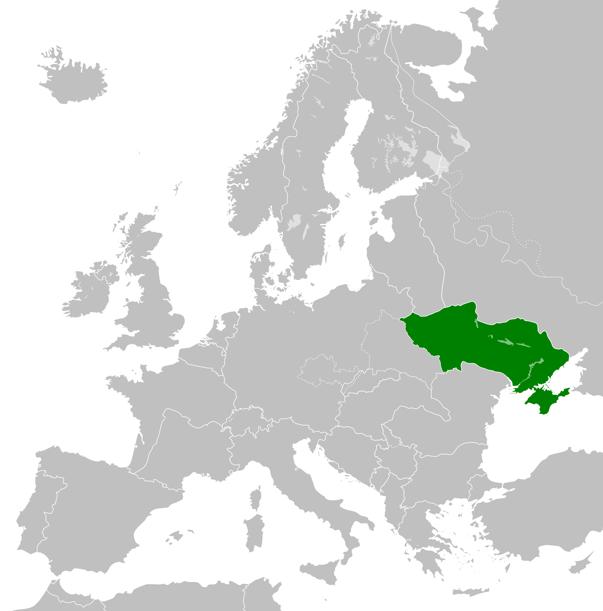
Ficheiro:Reichskommissariat Ukraine (1942).svg

Tamaño desta vista previa en PNG do ficheiro en formato SVG: 450 × 456 píxeles. Outras resolucións: 237 × 240 píxeles | 474 × 480 píxeles | 758 × 768 píxeles | 1.011 × 1.024 píxeles | 2.021 × 2.048 píxeles.
Ficheiro orixinal (ficheiro SVG; resolución de 450 × 456 píxeles; tamaño do ficheiro: 480 kB)
| Este ficheiro procede de Wikimedia Commons. A continuación móstrase a información da súa páxina de descrición. Commons é un repositorio libre de ficheiros multimedia. Pode contribuír alí cargando as súas imaxes. |


.svg)
.svg)
.svg)
.svg)
.svg)


.svg)
.svg)
.svg)


.png)
.png)


.svg)


.svg)

.svg)


.svg)
.svg)
.svg)
.svg)


.svg)
.png)


.svg)


.svg)
.svg)


.svg)


.svg)


.svg)
.svg)
.svg)
.svg)
.svg)
.svg)
.svg)
.svg)
_cropped.svg)
.svg)
.svg)
.svg)
.svg)
.svg)
.svg)
.svg)
.svg)
.svg)
.svg)
.svg)
.svg)
.svg)
.svg)
.svg)
.svg)
.svg)
.svg)
.svg)
.svg)
.svg)
.svg)
.svg)
.svg)
.svg)
.svg)
.svg)
.svg)
.svg)
.svg)
.svg)
.svg)
.svg)
.svg)
.svg)
.svg)
.svg)
.svg)
.svg)
.svg)
.svg)
.svg)
.svg)
.svg)
Historial do ficheiro
Prema nunha data/hora para ver o ficheiro tal e como estaba nese momento.
| Data/Hora | Miniatura | Dimensións | Usuario | Comentario | |
|---|---|---|---|---|---|
| actual | 7 de maio de 2023 ás 03:48 | | 450 × 456 (480 kB) | Lvivske | OG map more accurate. By accounts in both body and the discussion page in 2014, Crimea was "officially" part of Reich Ukraine |
| 31 de marzo de 2014 ás 09:23 |  | 450 × 456 (500 kB) | GayTenn | Crimea not part of Reichskommissariat Ukraine | |
| 8 de xullo de 2013 ás 03:18 |  | 450 × 456 (480 kB) | TRAJAN 117 | {{Information |Description ={{en|1=Reichskommissariat Ukraine in 1942.}} |Source ={{own}} {{AttribSVG|Europe 1942.svg|Alphathon}} |Author =TRAJAN 117 |Date =2013-07-08 |Permission ={{Self|GFDL|cc-by-... |
Uso do ficheiro
A seguinte páxina usa este ficheiro:
Uso global do ficheiro
Os seguintes wikis empregan esta imaxe:
- Uso en ar.wikipedia.org
- Uso en az.wikipedia.org
- Uso en be.wikipedia.org
- Uso en ca.wikipedia.org
- Uso en cs.wikipedia.org
- Uso en de.wikipedia.org
- Uso en en.wikipedia.org
- Uso en es.wikipedia.org
- Uso en fa.wikipedia.org
- Uso en fi.wikipedia.org
- Uso en fr.wikipedia.org
- Uso en he.wikipedia.org
- Uso en id.wikipedia.org
- Uso en it.wikipedia.org
- Uso en ja.wikipedia.org
- Uso en ko.wikipedia.org
- Uso en lt.wikipedia.org
- Uso en ms.wikipedia.org
- Uso en mt.wikipedia.org
- Uso en no.wikipedia.org
- Uso en pap.wikipedia.org
- Uso en pl.wikipedia.org
- Uso en pnb.wikipedia.org
- Uso en pt.wikipedia.org
- Uso en ro.wikipedia.org
- Uso en ru.wikipedia.org
- Uso en sk.wikipedia.org
- Uso en sq.wikipedia.org
- Uso en sr.wikipedia.org
- Uso en th.wikipedia.org
- Uso en tr.wikipedia.org
- Uso en ur.wikipedia.org
- Uso en vi.wikipedia.org
- Uso en www.wikidata.org
- Uso en zh-yue.wikipedia.org
- Uso en zh.wikipedia.org
.svg)