
Ficheiro:Netherlands with provinces.png
Non se pode ver nunha resolución meirande.
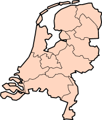
Netherlands_with_provinces.png (200 × 235 píxeles; tamaño do ficheiro: 23 kB; tipo MIME: image/png)
| Este ficheiro procede de Wikimedia Commons. A continuación móstrase a información da súa páxina de descrición. Commons é un repositorio libre de ficheiros multimedia. Pode contribuír alí cargando as súas imaxes. |
Description: Map of the Netherlands, with provinces. Description: Map for localisazion of the province of Friesland in the Netherlands.
Clickable version


|
Autorízase a copia, distribución e/ou modificación deste documento baixo os termos da licenza de documentación libre GNU, versión 1.2 ou calquera outra que posteriormente publique a Free Software Foundation; sen seccións invariables, textos de portada, nin textos de contraportada. Inclúese unha copia da devandita licenza na sección titulada GNU Free Documentation License. |
| Este ficheiro está licenciado baixo a licenza Creative Commons recoñecemento compartir igual 3.0 sen adaptar. | ||
| ||
| A etiqueta desta licenza engadiuse a este ficheiro como parte da actualización da licenza GFDL. |
| Anotacións | Esta imaxe ten anotacións: Olle as anotacións en Commons |


Historial do ficheiro
Prema nunha data/hora para ver o ficheiro tal e como estaba nese momento.
| Data/Hora | Miniatura | Dimensións | Usuario | Comentario | |
|---|---|---|---|---|---|
| actual | 30 de xullo de 2005 ás 13:59 | | 200 × 235 (23 kB) | J.Hollemans~commonswiki | '''Description:''' Map of the Netherlands, with provinces. {{GFDL}} Category:Maps of Netherlands |
Uso do ficheiro
As seguintes 3 páxinas usan este ficheiro:
Uso global do ficheiro
Os seguintes wikis empregan esta imaxe:
- Uso en af.wikipedia.org
- Uso en an.wikipedia.org
- Uso en br.wikipedia.org
- Uso en ce.wikipedia.org
- Uso en da.wikipedia.org
- Leiden
- Haag
- Amsterdam
- Rotterdam
- Eindhoven
- Groningen
- Utrecht
- Wikipedia:Skabeloner/Geografi
- Enschede
- Nijmegen
- Hengelo
- Tilburg
- Waalwijk
- Maastricht
- Noord-Holland
- Gelderland
- Groningen (provins)
- Schiermonnikoog
- Ameland
- Leeuwarden
- Harlingen
- Zuid-Holland
- Zeeland
- Borne
- Noord-Brabant
- Limburg (nederlandsk provins)
- Bonaire
- Terschelling
- Haarlem
- Frisland (Nederlandene)
- Zeist
- Vlaardingen
- Delft
- Arnhem
- Leek
- Overijssel
- Saba (Caribien)
- Skabelon:Nederlandske provinser
- Wijchen
- Drenthe
- Flevoland
- Utrecht (provins)
Ollar o uso global deste ficheiro.