
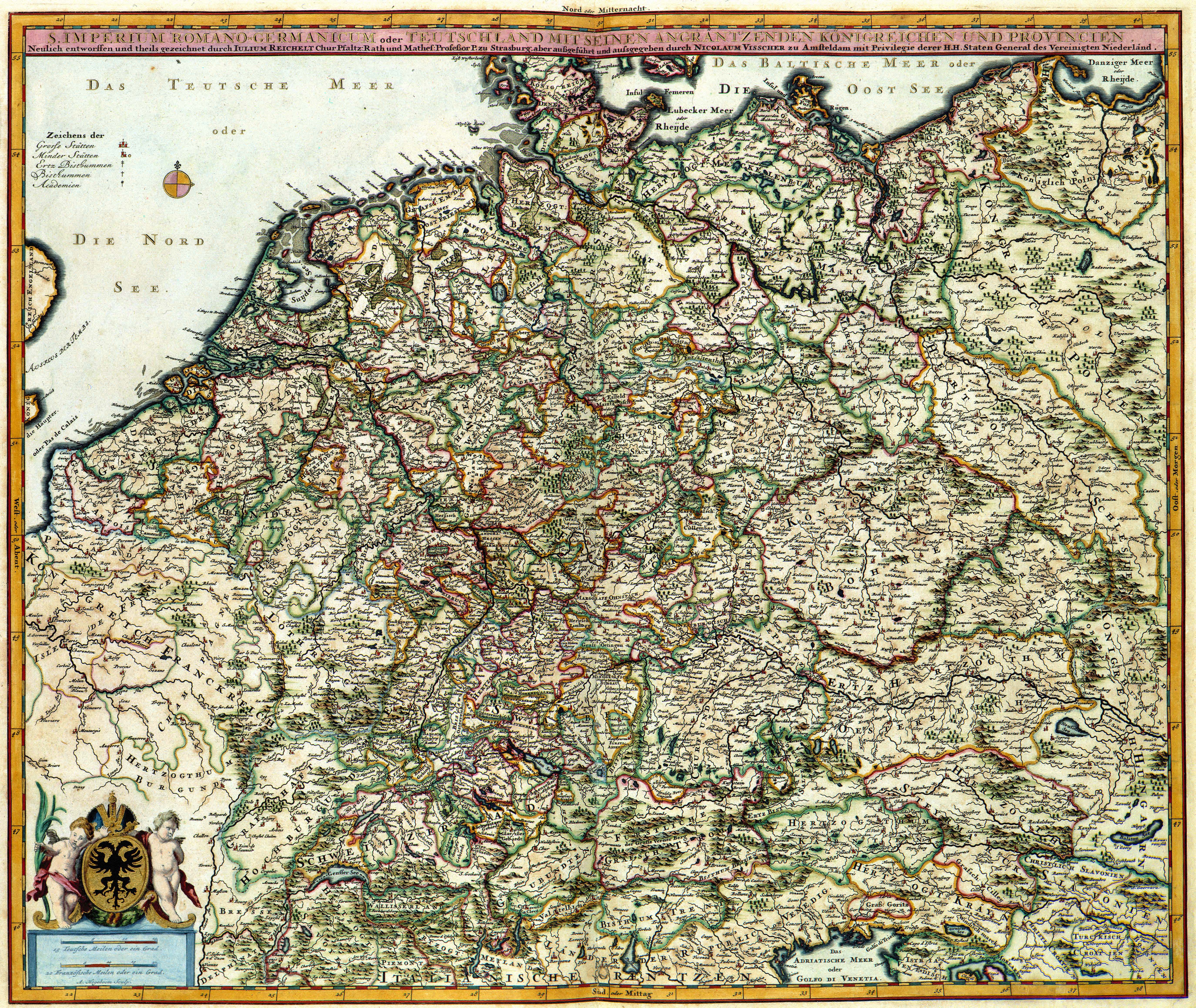
Ficheiro:Atlas Van der Hagen-KW1049B10 047-S. IMPERIUM ROMANO-GERMANICUM oder DEUTSCHLAND MIT SEINEN ANGRÄNTZENDEN KÖNIGREICHEN UND PROVINCIEN Neulich entworffen und theils gezeichnet durch IULIUM REICHELT Chur Pfaltz.jpg
Tamaño desta vista previa: 711 × 599 píxeles. Outras resolucións: 285 × 240 píxeles | 569 × 480 píxeles | 911 × 768 píxeles | 1.215 × 1.024 píxeles | 2.429 × 2.048 píxeles | 5.500 × 4.637 píxeles.
Ficheiro orixinal (5.500 × 4.637 píxeles; tamaño do ficheiro: 5,49 MB; tipo MIME: image/jpeg)
| Este ficheiro procede de Wikimedia Commons. A continuación móstrase a información da súa páxina de descrición. Commons é un repositorio libre de ficheiros multimedia. Pode contribuír alí cargando as súas imaxes. |
Resumo
| Dirk Jansz van Santen: Atlas van Dirk van der Hagen (volledig, collectie KB)
|
|||||||||||||||||||||||||||
|---|---|---|---|---|---|---|---|---|---|---|---|---|---|---|---|---|---|---|---|---|---|---|---|---|---|---|---|
| Artista |
Julius Reichelt Author: Julius Reichelt Publisher:
|
 | |||||||||||||||||||||||||
| Título |
S. IMPERIUM ROMANO-GERMANICUM oder DEUTSCHLAND MIT SEINEN ANGRÄNTZENDEN KÖNIGREICHEN UND PROVINCIEN Neulich entworffen und theils gezeichnet durch IULIUM REICHELT Chur Pfaltz |
||||||||||||||||||||||||||
| Tipo de objecto | estampa | ||||||||||||||||||||||||||
| Descrición |
Nederlands: Deze kaart van het Duitse Rijk werd ontworpen door Julius Reichelt (1637-1717). Van Reichelt is weinig meer bekend dan dat hij hoogleraar in de wiskunde aan de Universiteit van Straatsburg was. Van zijn kaart verschenen tijdens de 17de en 18de eeuw verschillende bewerkingen. Deze bewerking is van de hand van de uitgever Nicolaes Visscher II (1649-1702).
English: This map of the German Empire was designed by Julius Reichelt (1637-1717). Reichelt was professor of mathematics at the University of Strassburg. During the 18th century many derivations appeared. This reproduction was published by Nicolaes Visscher II (1649-1702). |
||||||||||||||||||||||||||
| Lingua |
lingua neerlandesa |
||||||||||||||||||||||||||
| Data | despois do 1681 | ||||||||||||||||||||||||||
| Data de publicación |
entre |
||||||||||||||||||||||||||
| Medio |
Nederlands: kopergravure
English: gravura em cobre |
||||||||||||||||||||||||||
| Dimensións | 47 x 56 cm | ||||||||||||||||||||||||||
| Colección |
|
||||||||||||||||||||||||||
| Número de acceso |
Description of the Atlas Van der Hagen in the catalogue of the KB: http://opc4.kb.nl/DB=1/TTL=1/LNG=EN/PPN?PPN=353012750 |
||||||||||||||||||||||||||
| Lugar de criação | Amsterdam | ||||||||||||||||||||||||||
| Notas | KW1049B10_047 - Volume 1 | ||||||||||||||||||||||||||
| Related persons | Nicolaes Visscher II - Reichelt, Julius | ||||||||||||||||||||||||||
| Depicted locations | German Empire | ||||||||||||||||||||||||||
| Referencias | |||||||||||||||||||||||||||
| Orixe/Fotógrafo |
Source page at the Geheugen van Nederland / Memory of the Netherlands website.
|
||||||||||||||||||||||||||

Licenza
|
Esta é unha reproducción fotográfica fiel dunha obra de arte bidimensional no dominio público. A obra de arte en si mesma atópase no dominio público polo seguinte motivo:
A posición oficial da Fundación Wikimedia é que "as reproducións fieis de obras de arte bidimensionais no dominio público atópanse en si mesmas no dominio público".
Esta reprodución fotográfica considérase polo tanto no dominio público. Noutras xurisdicións a reutilización deste contido pode estar rextrinxida; vexa Reutilización de fotografías PD-Art para máis información. | ||||
Historial do ficheiro
Prema nunha data/hora para ver o ficheiro tal e como estaba nese momento.
| Data/Hora | Miniatura | Dimensións | Usuario | Comentario | |
|---|---|---|---|---|---|
| actual | 19 de xullo de 2015 ás 04:21 | | 5.500 × 4.637 (5,49 MB) | OlafJanssen | GWToolset: Creating mediafile for OlafJanssen. |
Uso do ficheiro
A seguinte páxina usa este ficheiro:
Uso global do ficheiro
Os seguintes wikis empregan esta imaxe:
- Uso en be-tarask.wikipedia.org
- Uso en bn.wikipedia.org
- Uso en bs.wikipedia.org
- Uso en ckb.wikipedia.org
- Uso en en.wikipedia.org
- German Empire
- East Germany
- History of Germany
- Holy Roman Empire
- Nazi Germany
- West Germany
- Weimar Republic
- Flight and expulsion of Germans (1944–1950)
- German reunification
- German diaspora
- German Confederation
- Kingdom of Prussia
- North German Confederation
- History of Germany (1945–1990)
- German Reich
- Francia
- Template:History of Germany sidebar
- Confederation of the Rhine
- List of years in Germany
- East Francia
- Allied-occupied Germany
- Military history of Germany
- Kingdom of Germany
- Kleinstaaterei
- History of German
- History of Germany during World War I
- Economic history of Germany
- History of Saxony
- Names of Germany
Ollar o uso global deste ficheiro.